

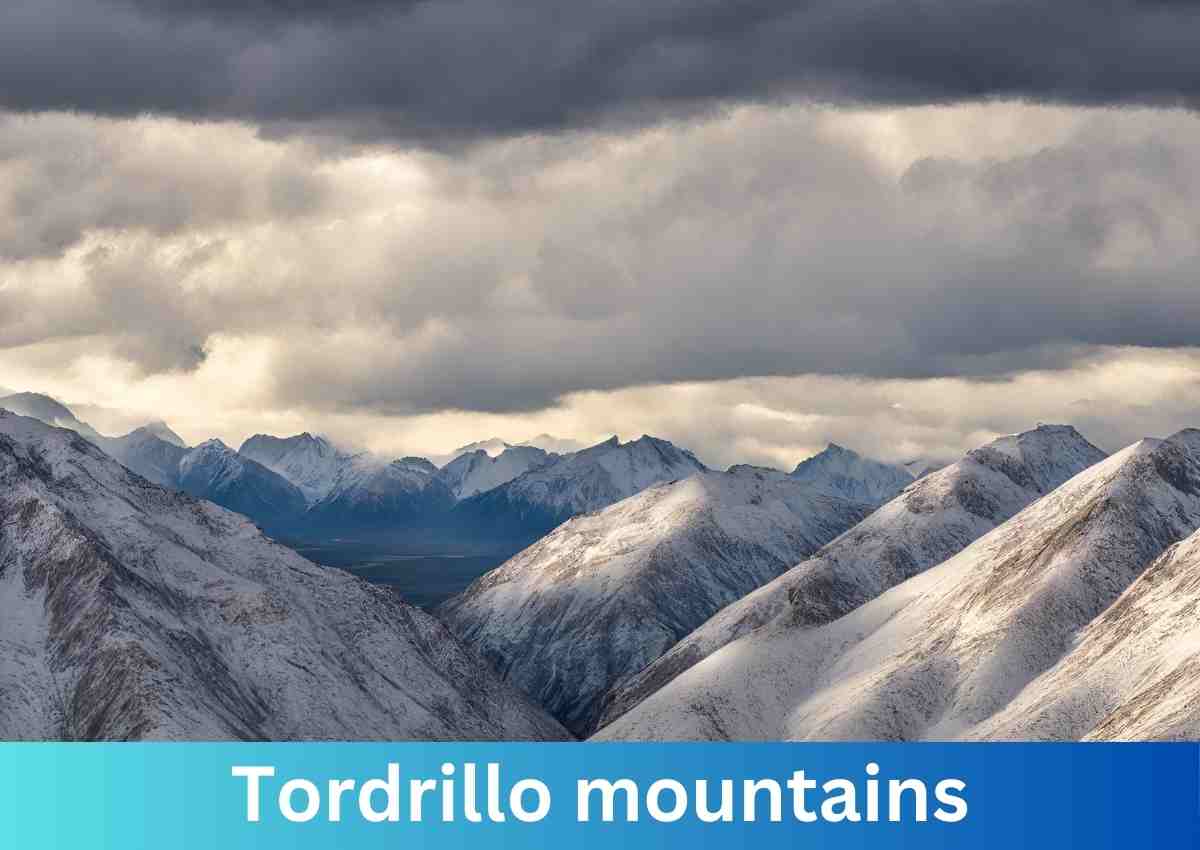
Nestled within the vast and pristine landscape of southcentral Alaska, the Tordrillo Mountains stand as a captivating testament to the untamed beauty of the Last Frontier.
Located approximately 75 miles west-northwest of Anchorage, this small mountain range extends its rugged embrace across the Matanuska-Susitna and Kenai Peninsula Boroughs, offering a playground for adventurers seeking the allure of untouched wilderness.
Geographical Overview
Stretching approximately 60 miles north-south and 35 miles east-west, the Tordrillo Mountains boast an impressive topography, with the highest peak, Mount Torbert, soaring to an elevation of 11,413 feet.
Positioned strategically, these mountains are easily visible from Anchorage, creating a dramatic backdrop to the bustling city on clear days.
Volcanic Majesty And Glacial Grandeur
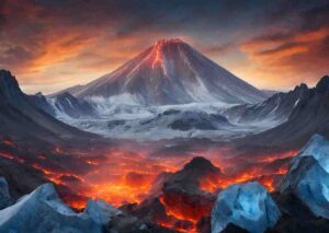
Primarily a volcanic range, the Tordrillos exhibit a remarkable blend of fire and ice. While Mount Spurr, the southernmost peak, had its most recent eruption in June 1992, not all the peaks, such as Mount Torbert, are volcanoes.
The heavy glaciation of the range, including prominent glaciers like Capps Glacier, Triumvirate Glacier, Hayes Glacier, and Trimble Glacier, adds to the mystique, partly attributed to their proximity to Cook Inlet.
A Hidden Gem
Despite their proximity to Anchorage, the Tordrillos remain largely untouched, with nearly one million acres awaiting exploration. This makes them one of Alaska’s most accessible and beautiful ranges.
The region is a haven for outdoor enthusiasts, offering a plethora of activities such as skiing, snowboarding, hiking, ice climbing, fishing, whitewater rafting, mountaineering, and wildlife viewing.
Named Peaks And Unique Features
The Tordrillo Mountains boast a lineup of majestic peaks, each with its own story to tell. From the towering Mount Torbert to the heavily ice- and snow-covered Mount Spurr, these peaks contribute to the unique tapestry of the Alaskan wilderness. Other notable features include Mount Gerdine, Hayes Volcano, and the subsidiary peak, Crater Peak.
Interesting Facts
- Total Area: 3,858 square miles and approximately 1.2 million acres
- Central Coordinates: 61° 27’ N; 151° 41’ W
- Average Snowfall: A staggering 600 inches
- Mount Torbert, the tallest peak, stands at 11,413 feet and is predominantly comprised of glaciers, with its melt contributing to the Cook Inlet, Gulf of Alaska, and eventually the Pacific Ocean.
Other major peaks And activities
- Mount Talachulitna (11,100 ft.): The river formed by snowmelt from this peak, known as “The Tal,” offers excellent rafting opportunities and is the first catch-and-release-only river for Rainbow Trout in Alaska.
- Mount Spurr (11,070 feet) is a heavily ice- and snow-covered volcano, with its last known summit eruption occurring over 5,000 years ago.
- Crater Peak (7,575 feet) is a subsidiary peak of Mount Spurr, offering unique perspectives on volcanic activity.
Tordrillo Mountain Lodge
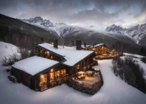
Situated on the banks of Judd Lake, where it meets the Talachulitna River, the Tordrillo Mountain Lodge provides a gateway to summer activities such as stand-up paddleboarding, kayaking, rafting, and fishing. The stunning backdrop includes views of North America’s tallest peak, Mount McKinley.
In the heart of the Tordrillo Mountains, nature’s grandeur unfolds, inviting explorers to uncover the secrets of this untouched wilderness. Whether scaling the heights of Mount Torbert or navigating the pristine waters of the Tal, the Tordrillos offer an unforgettable journey into the heart of Alaska’s untamed majesty.